
Celebrating Geographic information systems (GIS). Properly.
Last month, the world celebrated one of the environmental science's most trusted and critically needed tools: Geographic Information Systems (GIS). While World GIS Day itself was overshadowed by turkey feasts and family get-togethers, we at Waternborne were grateful, which is why we decided to give GIS its due and time in the sun with no other holiday distractions.
GIS are technologies that capture, store, analyze, and visualize data tied to specific locations on Earth. At their core, GIS platforms integrate layers of spatial information, such as terrain, land use, infrastructure, hydrology, or biological distributions, so users can explore relationships, patterns, and trends that aren’t visible in tabular data alone. The concept grew from early cartography and computer-aided mapping in the mid-20th century, with major advances occurring as computing power increased and satellite imagery became widely available. By the 1960s and 1970s, governments and research institutions were developing digital mapping systems, laying the foundation for today’s robust GIS software and cloud-based spatial data infrastructures.
It's not an overstatement to say that GIS are a critical part of how scientists approach environmental challenges. We use it to model watersheds, evaluate habitat suitability, track species distributions, identify pollution sources, and assess risks associated with climate change, natural hazards, or land-use change. GIS also helps translate complex datasets into clear visualizations that inform regulators, land managers, and the public. Whether mapping endangered species habitats under the Endangered Species Act, assessing pesticide drift risks, or planning conservation corridors, GIS connects environmental data to real-world geography, enabling more accurate analyses and more informed environmental management.
Let's consider some of the ways GIS aids us in our quest for scientific truth:
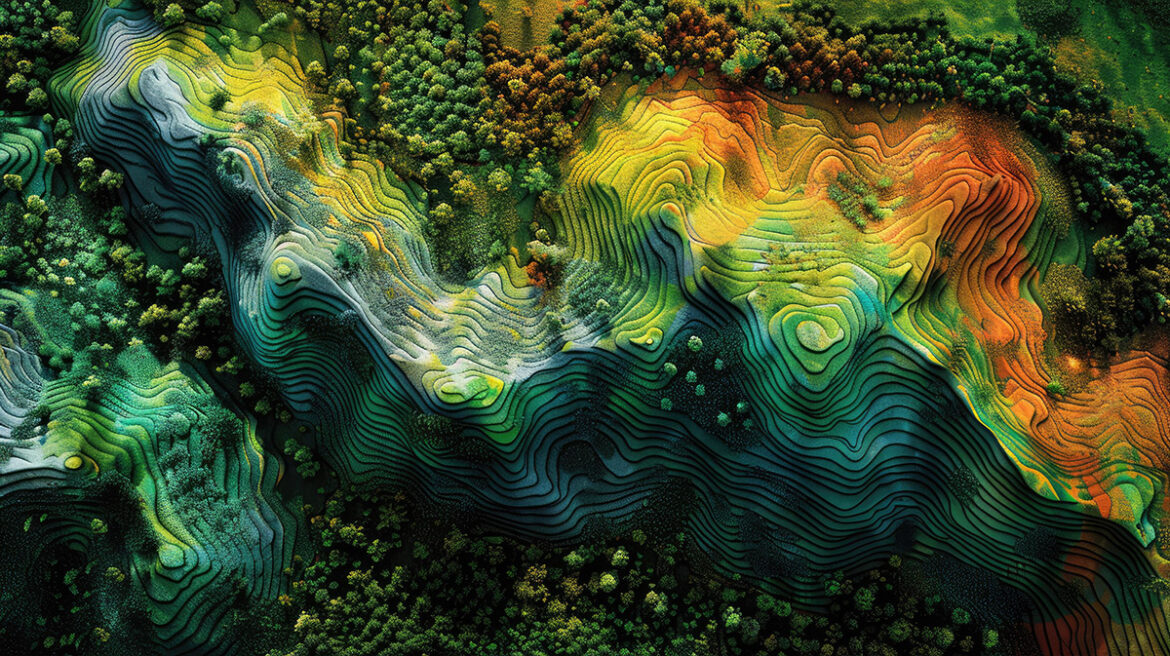
 Remote Sensing
Scientists frequently use remote sensing and high-resolution imagery to gather up-to-date environmental information. Waterborne's own team employs multiple satellite platforms and leverages these data sources to identify land-use patterns and environmental features relevant to each project’s scope. In keeping with our modern age, machine learning techniques are often applied to classify broad land-cover categories, using training data developed from high-resolution imagery. For example, GIS is useful in visualizing vegetation patterns through spectral indices such as NDVI, which help reveal changes in vegetation health and seasonal dynamics. These combined approaches allow scientists to detect features that may otherwise be difficult to distinguish and support accurate environmental assessments.
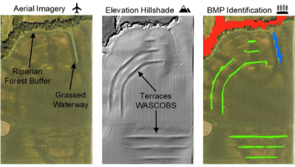
Spatial Analysis
GIS is particularly useful in helping scientists understand how landscapes shift over time and what those changes mean for environmental conditions. By analyzing spatial trends in land use, crop rotations, and other factors, scientists can determine what is impacting soil health and the potential for erosion. GIS also plays a key role in modeling work, where spatial datasets are selected and processed to meet model requirements. This may include identifying land cover, crop prevalence, slopes, soils, or precipitation patterns — data essential for producing reliable results that reflect complex environmental interactions. Additionally, GIS assists clients with site identification by locating areas that share similar environmental characteristics across regions.
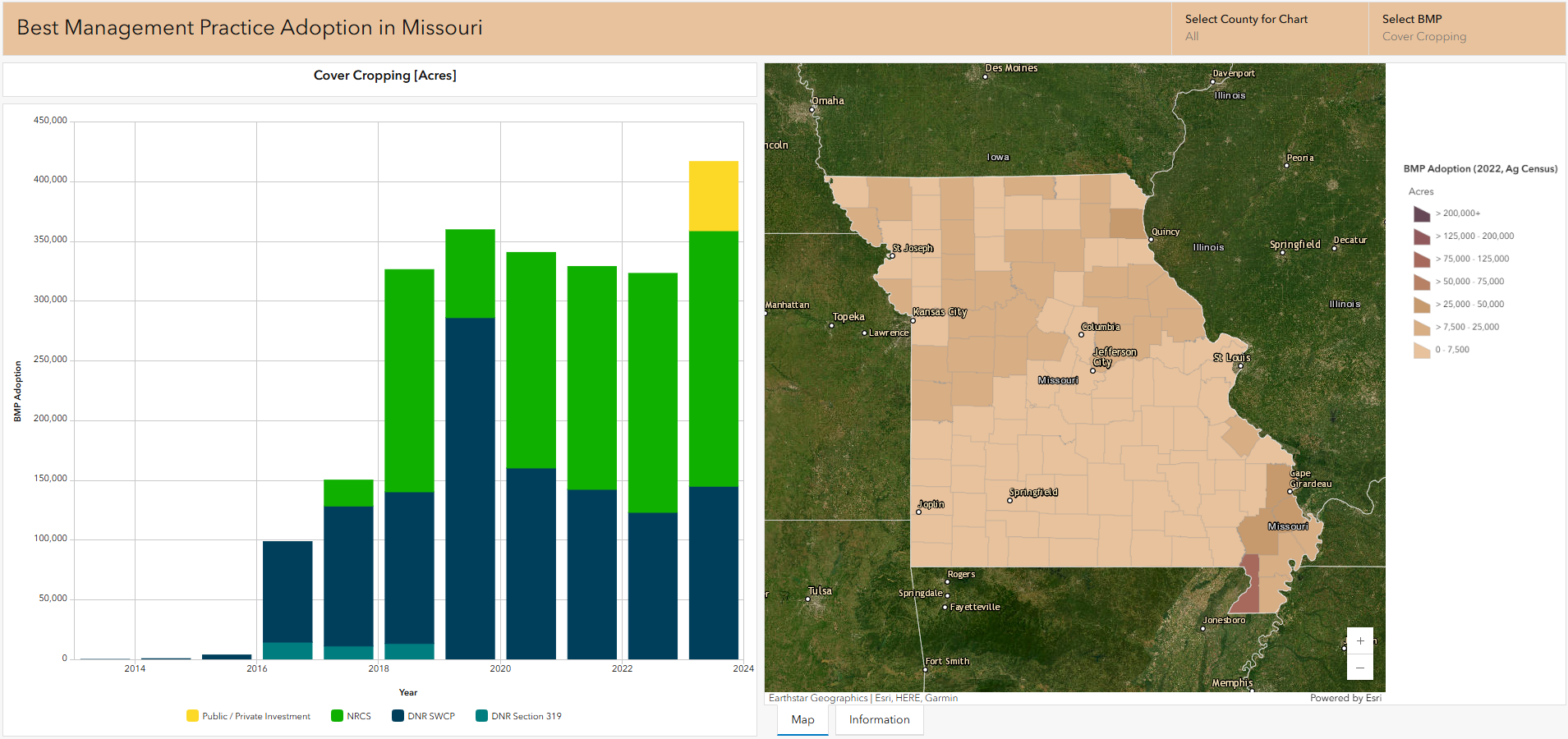
Web Mapping
The next stage for GIS use is found in interactive, web-based products that make complex environmental data accessible to users. These tools allow stakeholders to explore spatial information, evaluate characteristics in the field, and better understand environmental conditions. At Waterborne, our scientists employ modern web GIS platforms to create custom dashboards and web pages that help clients visualize trends, track progress, and support informed decision-making. These tools bridge the gap between expert analysis and public understanding by summarizing key insights while enabling users to explore data at multiple scales.
Waterborne's Involvement
Given the advantages GIS offer, coupled with Waterborne’s commitment to deliver high-quality environmental analysis through geospatial technology, it's no surprise that our scientists use this technology daily. By integrating remote sensing, spatial analysis, and interactive web-based mapping, our team transforms complex environmental data into clear results for clients and the public. Whether supporting modeling efforts, monitoring landscapes, or enabling clients to better understand field conditions, our GIS approach allows our clients to make data-based decisions that promote environmental stewardship across the world.
EPA’s Proposed Rollback of Chemical Safety Protections: What It Means for Environmental Stewardship
EPA’s Proposed Rollback of Chemical Safety Protections: What It Means for Environmental Stewardship March 2, 2026 | Endangered Species |…
READ MORE

Waterborne kicks off 2026 at NAICC in Orlando, FL
Waterborne kicks off 2026 at NAICC in Orlando, FL March 2, 2026 | Waterborne News | Jennifer TraskLast month, the…
READ MORE
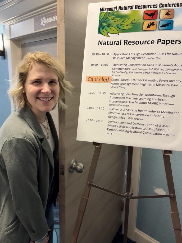
Recap of the Missouri Natural Resources Conference 2026
Recap of the Missouri Natural Resources Conference 2026 March 2, 2026 | Field Studies | Martha Gerig, PhDAs I pulled…
READ MORE
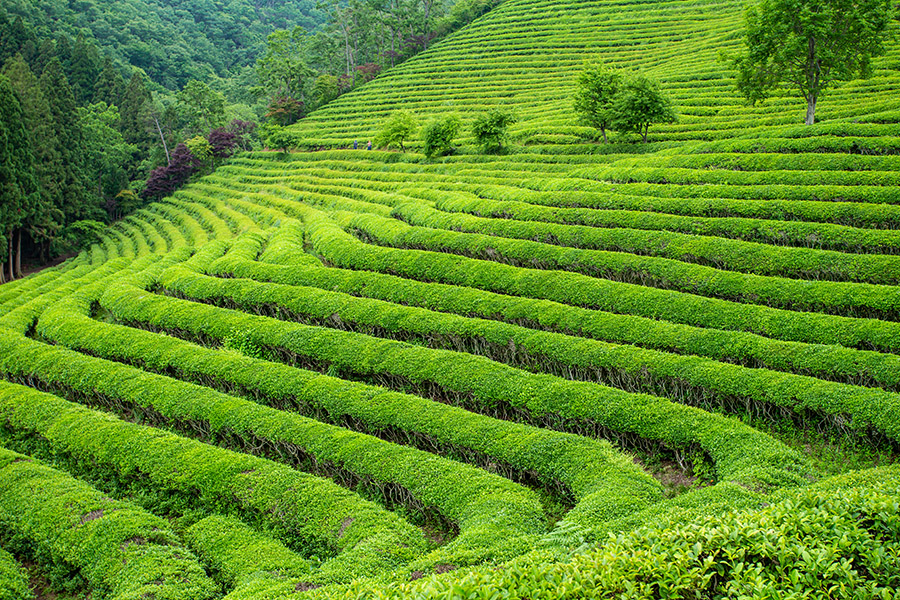
Growing tea isn’t for the faint of heart
Growing tea isn’t for the faint of heart January 26, 2026 | Climate Change | This month’s frigid temperatures have…
